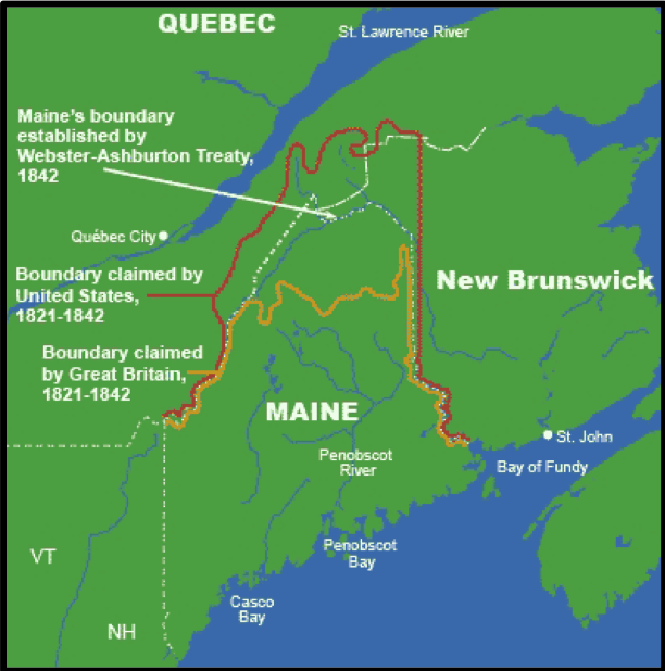
The Shape of Maine
Viewing early maps of the District of Maine, one is struck by the subtle shifts in its northeast boundaries through the years. For over a half a century, Maine and British New Brunswick disputed the entire eastern and northern frontier, a conflict that culminated in the so-called Aroostook War (1838-1839) and was finally resolved with the Treaty of Washington, or Webster-Ashburton Treaty, signed in 1842, which allocated Maine 7,015 square miles of disputed territory. The border conflict grew out of ambiguities in the 1783 Treaty of Paris, the agreement that ended the American Revolution. Following its admission to the union as a state in 1820, Maine was anxious to define the boundary that had been in question since the end of the Revolutionary War. New Brunswick, with an economy dependent upon the expanding mast and timber trade, was equally interested in the heavily timbered region on the Aroostook and St. John rivers. Each felt that history justified its claims to the disputed territories. The Treaty of Ghent ended the War of 1812 and reestablished the boundary line of the 1783 treaty, also including a provision of a third-party arbitrator to resolve future boundary disputes. In 1830, King William I of the Netherlands was called upon to settle the dispute. However, the United States dismissed his final calculation and the dispute continued until 1842, when both countries adopted the Webster-Ashburton Treaty.
